
Best Walking Routes Around Bicester: 5 Circular Walks
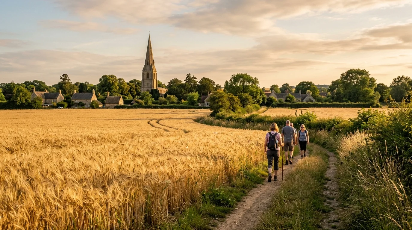
You step out of your front door on a bright Saturday morning, lace up your walking shoes, and within ten minutes find yourself strolling past open wheat fields and gentle Oxfordshire hedgerows. While Bicester continues to grow with modern garden town communities, the surrounding countryside remains criss-crossed by ancient public rights of way, peaceful woodland reserves, and scenic river meadows. Exploring these local footpaths gives you a wonderful opportunity to recharge outdoors, discover historic rural hamlets, and enjoy fresh air without travelling far from home. Whether you need a pushchair-friendly loop around a local nature reserve or a brisk five-mile trek across open farmland, our guide to the finest walks near Bicester provides five verified circular routes for every fitness level.
TL;DR: 5 Best Circular Walks Near Bicester
- What this post covers: Five detailed circular walks near Bicester, complete with exact starting points, postcodes, trail distances, terrain descriptions, and seasonal highlights.
- Why it matters to Bicester residents now: Stepping directly onto waymarked Oxfordshire footpaths provides immediate outdoor recreation, exercise, and mental well-being right on your doorstep.
- The key highlight: The routes range from paved nature reserve loops along the River Bure to scenic countryside circuits connecting historic villages like Chesterton, Launton, and Stratton Audley.
- What practical information you will get: Exact trailhead postcodes, parking guidance, navigation advice using the Go Jauntly app, dog walking recommendations, and volunteer group contact details.
- A single immediate action you can take: Choose your preferred route from our table, download your local footpath map, and explore one of these rewarding walks near Bicester or discover nearby parks and green spaces in Bicester this weekend.
What Are the Best Circular Countryside and Parkland Walks Near Bicester?
Finding a well-planned circular route saves you from retracing your steps and ensures a varied journey through changing landscapes. North Oxfordshire features a gently undulating terrain formed of limestone cornbrash and Oxford clay, creating peaceful walking conditions suitable for casual ramblers and seasoned hikers alike. The five selected routes below offer distinct experiences, ranging from wheelchair-accessible town park circuits to rural trails through historic farming parishes.
| Walk Name | Distance | Approximate Time | Starting Point & Postcode | Terrain & Accessibility |
|---|---|---|---|---|
| 1. Bure Park Nature Reserve Loop | 2.5 miles (4.0 km) | 45 to 60 mins | Lucerne Avenue Car Park, OX26 3HA | Paved pathways and level timber boardwalks; fully pushchair and wheelchair accessible |
| 2. Langford Brook & Jubilee Lake Circuit | 3.1 miles (5.0 km) | 60 to 75 mins | Nightingale Place / Community Centre, OX26 6XX | Surfaced aggregate paths, grassy meadow edges; level terrain suitable for all ages |
| 3. Island Pond Wood & Launton Loop | 3.8 miles (6.1 km) | 75 to 90 mins | Garth Park, OX26 6PS or West End, OX26 5DB | Grassy field margins, woodland dirt tracks, kissing gates; can become muddy in winter |
| 4. Chesterton & Akeman Street Country Walk | 4.2 miles (6.8 km) | 80 to 100 mins | Whitelands Farm Sports Ground, OX26 1AJ | Public footpaths across farmland, rustic stiles, quiet country lanes; moderate footwear required |
| 5. Stratton Audley Parkland & Village Trail | 4.8 miles (7.7 km) | 90 to 120 mins | The Red Lion, Church Street, OX27 9DB | Public bridleways, grassy farm tracks, quiet rural lanes; sturdy walking boots recommended |
Walk 1: Bure Park Nature Reserve Circular (West Bicester)
The Bure Park Nature Reserve circular walk provides one of the most accessible green corridors in the entire district. Starting from the free visitor car park on Lucerne Avenue (OX26 3HA), the 2.5-mile path loops alongside the meandering River Bure through twenty-five acres of protected wetland, scrub, and wildflower meadow. Smooth tarmac paths and sturdy timber boardwalks allow parents with pushchairs and individuals using mobility equipment to enjoy the wetland habitats throughout the year without encountering muddy obstacles.
As you follow the watercourse north towards the railway bridge and circle back past the balancing pond, you will notice native willow trees, alder copses, and seasonal water mint thriving along the banks. Informative interpretive panels positioned along the route explain the life cycles of resident wildlife, including kingfishers, dragonflies, and great crested newts. For residents living in Highfield or the newer Elmsbrook eco-town, this tranquil route offers a peaceful morning stroll before work. You can read more about this area in our comprehensive Bure Park and Highfield guide or explore our dedicated Bure Park Nature Reserve guide.
Walk 2: Langford Brook & Jubilee Lake Circuit (South-East Bicester)
Covering 3.1 miles across the south-eastern quadrant of town, the Langford Brook circular route connects landscaped linear parkland with wide open meadow basins. You can begin at the Langford Village Community Centre on Nightingale Place (OX26 6XX), where parking is readily available. The path follows the tree-lined course of Langford Brook southward, guiding you along wide aggregate pathways that stay relatively firm even after autumn rain showers.
The circuit loops around the peaceful waters of Jubilee Lake, where mallards, moorhens, and mute swans glide across the surface. This route also incorporates sections of the official Cherwell Langford Health Route and borders the open playing fields that host the weekly 5-kilometre running community. If you want to combine walking with Saturday morning running events, take a look at our detailed Bicester parkrun guide for volunteer schedules, or explore the water meadow paths in our Langford Meadows and River Ray nature walk guide.
Walk 3: Island Pond Wood & Launton Countryside Loop (East Bicester)
For walkers seeking a blend of town parkland and authentic village heritage, the 3.8-mile Island Pond Wood circular walk delivers a delightful rural escape. Starting at the historic wrought-iron gates of Garth Park on Launton Road (OX26 6PS), you follow the waymarked public footpaths eastward across the Charbridge Lane footbridge and into the open agricultural fields buffering Launton village.
The highlight of this route is Island Pond Wood, a four-hectare community woodland on West End (OX26 5DB) lovingly planted and maintained by local village volunteers since 1999. A circular bark pathway winds between maturing oak, ash, and hazel trees towards a secluded wildlife pond bordered by yellow flag irises and native reeds. After exploring the woodland tracks, the loop passes near The Bull Inn on Bicester Road before returning across the fields towards town. It provides an ideal weekend walk with plenty of bench seating for quiet contemplation.
Walk 4: Chesterton & Akeman Street Country Walk (South-West Bicester)
Stepping south-west from the Kingsmere neighbourhood leads you onto historic walking routes Oxfordshire ramblers have cherished for centuries. Beginning at Whitelands Farm Sports Ground (OX26 1AJ), this 4.2-mile circular walk guides you along field boundaries towards the charming village of Chesterton. You will cross gentle stiles and follow public footpaths that run parallel to the ancient Roman military road of Akeman Street, which connected St Albans to Cirencester during the first century AD.
The route skirts the perimeter of the ancient Alchester Roman town archaeological monument, where earthen defensive banks remain visible across the pastures. Arriving in Chesterton, the trail passes the fourteenth-century St Mary’s Church and attractive thatched cottages built from local golden limestone. You can pause for refreshments at The Red Lion on Green Lane before following the quiet perimeter footpath back to Kingsmere. This route delivers a rich sense of regional history coupled with wide horizons across open farmland.
Walk 5: Stratton Audley Parkland & Village Trail (North Bicester)
Located three miles north-east of town, the conservation village of Stratton Audley provides the starting point for a tranquil 4.8-mile circular walk through traditional North Oxfordshire parkland. Parking courteously along Church Street near The Red Lion pub (OX27 9DB), you follow public bridleways and field tracks heading north towards the Tusmore estate boundary.
The trail traverses wide grassy headlands, crossing small stone packhorse bridges over bubbling brooks before circling south through restored hedgerows. During late summer, the golden wheat fields frame distant views of the historic church tower in the village centre. Because this route crosses working farm pastures, cattle and sheep graze in adjacent enclosures, making it essential to keep canine companions securely on leads. The route finishes back at the village crossroads, offering a classic English countryside ramble far removed from urban hustle.
Which Walking Routes Near Bicester Offer the Best Seasonal Scenery and Wildlife?
Every season brings distinct transformations to the countryside footpaths Bicester residents explore throughout the year. Spring arrives early in the sheltered woodland belts and river corridors, where snowdrops, wild primroses, and yellow celandines carpet the ground during March. As April turns to May, hedgerows along the Chesterton and Launton field margins burst into fragrant white hawthorn blossom, filling the air with sweet scents and welcoming the chatter of returning migrant songbirds like blackcaps and chiffchaffs.
Summer transforms the agricultural landscape into a shimmering expanse of swaying golden barley and ripening wheat. Walking the open bridleways around Stratton Audley on a warm July evening rewards you with spectacular golden-hour light and the distinctive aerial acrobatics of swifts hunting insects over the fields. In the damp meadows along Langford Brook, purple loosestrife, meadowsweet, and common knapweed attract hundreds of butterflies, including peacocks, red admirals, and marbled whites darting between flower heads.
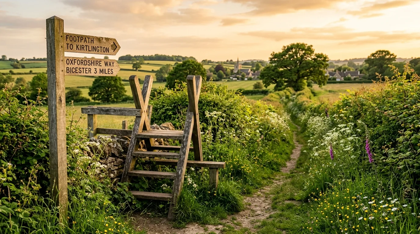
Autumn paints the local oak canopies, field maples, and hazel coppices in vivid shades of copper, amber, and russet gold. September and October provide ideal foraging conditions for blackberry pickers along the public rights of way connecting Bicester to nearby villages. Crisp winter mornings bring a peaceful stillness to the landscape, with frost dusting the river reeds at Bure Park and misty vapours rising from the wetlands. If you appreciate dramatic winter birdlife, pair these local paths with an afternoon excursion to the RSPB Otmoor nature reserve to witness thousands of starlings forming evening murmurations over the reedbeds.
How Are Local Volunteers and Walking Groups Caring for Bicester Footpaths?
The exceptional quality of walking routes in Oxfordshire around our town is sustained by the dedication of passionate local volunteers, civic societies, and community walking groups. Maintaining hundreds of miles of public rights of way requires continuous effort, from clearing overgrown summer brambles and repairing wooden stiles to surveying path conditions and installing clear fingerposts.
The Bicester and Kidlington Ramblers group plays a vital role across our district. Their dedicated volunteer path wardens walk every parish footpath systematically, reporting damaged gates and path obstructions directly to the Oxfordshire County Council Countryside Access team. In addition to maintenance work, the group organises a comprehensive weekly programme of led group walks, welcoming newcomers of all ages to discover scenic rural routes in safe, sociable company. Joining their organised weekend excursions provides a fantastic way for new residents to make friends and build walking confidence.
Local conservation groups contribute equally vital practical stewardship across our protected reserves. In Launton, the Friends of Island Pond Wood organise regular community work parties throughout the year, planting native saplings, clearing pond vegetation, and laying traditional hedges. Similarly, volunteer work parties at Bure Park collaborate with Cherwell District Council rangers to manage wetland reedbeds and protect sensitive wildlife habitats.
Long-time Bicester resident and volunteer path surveyor David Jenkins highlights the importance of community involvement: “Walking our local footpaths connects you directly to the history and natural rhythm of the land. When we replace an old broken stile with an accessible kissing gate or clear an overgrown field edge, we ensure that parents with young children and elderly residents can step into nature safely. Our public rights of way are a shared community treasure that grows more valuable with every generation.”
If you want to support practical trail maintenance or join guided community walking events, several local initiatives welcome new participants. Getting involved requires no previous experience and allows you to give back to the countryside you love:
- Bicester and Kidlington Ramblers: Hosts fortnightly weekend walks and mid-week social strolls across North Oxfordshire villages, with full details available on their official website.
- Friends of Island Pond Wood: Holds monthly weekend conservation mornings in Launton, providing tools and tea for enthusiastic volunteers.
- Cherwell Health Routes (Go Jauntly): Offers self-guided walking trails designed in partnership with local health teams to encourage daily active travel.
- Bicester Green Gym: Meets weekly to combine physical outdoor exercise with practical environmental conservation across local nature areas and parks.
You can also discover other free community activities and outdoor recreation by browsing our guide to free things to do in Bicester or exploring the historic landmarks on the Bicester Heritage trail. These self-guided itineraries showcase our town’s rich military and civic history while keeping you active outdoors.
How Should You Prepare for Walking Routes in Oxfordshire Around Bicester?
Proper preparation ensures your countryside ramble remains enjoyable, comfortable, and safe regardless of weather conditions. The heavy Oxford clay soil characteristic of our region retains moisture throughout late autumn and winter, turning field footpaths muddy after sustained rain. Equipping yourself with waterproof walking boots, gaiters, or rubber wellingtons between October and April will keep your feet dry and warm on unpaved field trails.
When navigating local footpaths Bicester countryside walkers benefit from using digital tools alongside traditional mapping. The free Go Jauntly mobile app features curated Cherwell Health Routes with step-by-step photographic directions and accessibility notes. For longer cross-country walks towards Stratton Audley or Chesterton, carrying the Ordnance Survey Explorer Map 180 (Oxford, Witney & Woodstock) or using the OS Maps mobile application allows you to verify public rights of way and avoid straying onto private agricultural land.
Use this practical decision framework to plan your walking outing based on your group’s specific preferences. Selecting the right path ensures everyone in your party has an enjoyable experience:
- If you are walking with a pushchair or mobility scooter: Choose the fully paved 2.5-mile Bure Park Nature Reserve loop (OX26 3HA) or the surfaced paths around Pingle Field recreation ground. These routes avoid stiles and provide firm footing in all weather.
- If you are walking with an energetic dog: Head for the wide field margins on the 3.8-mile Island Pond Wood loop in Launton or discover dedicated dog walking routes in Bicester alongside our guide to dog friendly places in Bicester. Always keep your dog on a short lead when crossing livestock pastures or passing ground-nesting birds.
- If you want a family adventure with historical discovery: Pick the 4.2-mile Chesterton and Akeman Street walk to spot Roman earthworks and thatched stone cottages, packing a picnic to enjoy on the village green.
- If you want a rewarding pub lunch after your ramble: Select the 4.8-mile Stratton Audley circular trail, reserving a table at The Red Lion on Church Street to enjoy hot food and local ales by the fireplace.
- If you prefer urban strolling and independent shopping: Take a gentle town centre stroll exploring historic lanes and welcoming cafes using our guide on a walk down Sheep Street.
- If you prefer exploring town trails on two wheels: Check our detailed guide to cycling in Bicester for segregated paths, country loops, and secure bike parking.
- If you are seeking more weekend leisure inspiration: Check our full directory of things to do in Bicester or view upcoming outdoor community events on the Bicester events calendar.
Stepping Out on the Best Countryside Paths Around Bicester
Taking time to explore the diverse circular walks near Bicester connects you with beautiful Oxfordshire countryside, rich heritage, and thriving wildlife right on your doorstep. Keep checking our local community guides for updated trail recommendations and seasonal outdoor events happening throughout the year.